Most people searching for an Everest Base Camp Helicopter Tour already know the destination. What they don’t know — and what almost no listing tells you clearly — is what the flight itself actually looks like. It isn’t a straight hop from Kathmandu to the base of the world’s tallest mountain. It’s a journey with stages, each one changing the scenery under you in a different way.
The real route moves roughly like this: Kathmandu to Lukla, Lukla into the Khumbu region, then up toward the Everest area itself before heading back the way it came, or close to it. Along the way, there’s usually a stop involved — sometimes for fuel, sometimes to let passengers out for photos, sometimes just because that’s how the operator has planned the day. None of this is fixed in stone. Weather, aircraft type, and the specific itinerary you’ve booked all shape how the flight unfolds. So rather than promising an exact script, this is meant to give you a genuine sense of what unfolds in front of the windscreen, section by section.
Kathmandu to Lukla: Where the Mountain Flight Really Begins
What the first part of the route looks like
The first stretch out of Kathmandu doesn’t feel dramatic right away. You’re still over the valley — terracotta rooftops, brick buildings, terraced fields on the hillsides ringing the city. Then, almost without announcing itself, the ground starts climbing. Hills turn into ridgelines, ridgelines turn into something steeper, and within twenty or so minutes the view out the window has gone from urban sprawl to deep green mountain folds with rivers cutting through the bottom of the valleys.
This is the part of the trip people mean when they search for Kathmandu to Lukla helicopter routes, and it’s worth understanding on its own terms. Lukla itself isn’t Everest Base Camp — it’s the gateway into the Khumbu, the small mountain town with the famously short airstrip that trekkers usually fly into before walking for days to reach the high Everest trails. On a helicopter tour, Lukla often works as an operational stop: a place where the aircraft might refuel, or where passengers switch between legs of the itinerary. Not every flight treats Lukla the same way, so it’s smart not to assume your specific trip follows an identical pattern to someone else’s photos online.
Lukla to the Khumbu: Entering the Everest Region
Past Lukla, the character of the flight changes again. You’re now inside what’s generally called the Khumbu — the valley system that funnels up toward Everest itself, dotted with small settlements, suspension bridges, and trails that trekkers spend a week or more covering on foot. From the air, all of that gets compressed into a handful of minutes. A village appears, then it’s behind you. A ridge that would take hours to climb slides past the window in seconds.
This is really the heart of what an Everest Base Camp helicopter tour is selling, if you strip away the marketing language: distance collapsed into time. The Khumbu Valley narrows as you go, the peaks on either side get taller, and snow starts appearing on slopes that were bare green just minutes earlier. Pilots pay close attention here — altitude changes fast, air gets thinner, and conditions that look fine from Kathmandu can shift once you’re deep in the mountains. Operators sometimes adjust routing or where exactly they plan to land based on what they’re seeing that morning, which is one more reason flight plans aren’t identical day to day.
Namche and Everest View: The Route’s Lower-Himalayan Perspective
Namche Bazaar sits in a kind of natural amphitheater, a bowl-shaped settlement carved into the hillside that’s become the unofficial capital of the Khumbu. From a helicopter, it looks almost staged — houses stacked up a curving slope, surrounded on nearly every side by steep terrain. It’s a useful point to orient yourself mentally on the route, because it marks where the lower Himalaya starts giving way to something much bigger.
Seeing Everest from around this altitude is different from reaching the Base Camp area itself — the mountain is visible, often strikingly so, but you’re still well below where the real high-altitude landscape takes over. Some operators, including Namcheheli, build their route information and operational stops around this stretch of the journey, since it tends to offer some of the clearest low-altitude mountain views before the terrain gets more demanding further ahead. This section isn’t about any one company, though — it’s really about understanding where you are in the bigger picture before the flight pushes into the high Khumbu.
From the Khumbu Valley Toward Everest Base Camp and Kala Patthar
Why the landscape changes so quickly
Beyond Namche, things start moving fast — not just the helicopter, but the scenery itself. Tengboche, Dingboche, Lobuche, and eventually Gorak Shep act as reference points along this stretch rather than stops on a trekking itinerary, though trekkers know them well as the villages marking the final push toward Base Camp. The vegetation thins out. Houses get sparser. Rock and ice start dominating what used to be green hillsides.
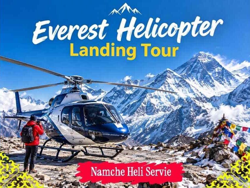
This is where the difference between the inhabited lower valleys and the rocky, wind-scoured upper Khumbu becomes obvious even to someone who’s never read a map of the region. Everest Base Camp, Gorak Shep, and Kala Patthar sit close together geographically, but they’re not interchangeable — Kala Patthar is actually a viewpoint above Base Camp, not the camp itself, and a lot of the classic Everest photography comes from up there rather than from the Base Camp site. It’s also worth being upfront about something: a helicopter doesn’t automatically land right at Base Camp and sit there waiting. Whether and where a landing happens depends on the day’s weather, safety assessments, and whatever arrangement your specific tour has made. Some flights land nearby, some circle, some adjust entirely based on conditions that morning.
Lobuche to Kathmandu Helicopter: What the Return Route Looks Like
A fair number of people search specifically for a Lobuche to Kathmandu helicopter route, usually because Lobuche shows up on itineraries as a reference point near the upper end of the Khumbu, not far from where Base Camp routing happens. The return leg from around here isn’t just “the helicopter turns around and goes back” — it’s a genuine shift in landscape, just running in reverse.
High mountains and glacial terrain gradually soften into the mid-altitude valleys, and eventually the deep green hills that marked the start of the outbound flight reappear as Kathmandu gets closer. Exact routing on this return leg can vary for the same reasons as everything else on this trip — air traffic around Kathmandu, weather systems moving through the mountains, and whatever the day’s flight plan calls for. If you’re booking a tour that specifically mentions Lobuche, it’s worth confirming with the operator how that fits into your particular itinerary rather than assuming a fixed path.
Lukla to Kathmandu Helicopter: Why the Return Can Feel Completely Different
By the time a Lukla to Kathmandu helicopter leg kicks in on the way home, most travelers notice something: the return flight doesn’t feel like a replay of the trip out. You recognize landmarks now — that ridge, that valley bend, that cluster of houses — because you saw them from a different angle a few hours earlier. The descent out of the mountain environment and back toward the lower hills has its own rhythm, usually calmer than the climb in.
One practical point worth repeating here: mountain flights run on weather, not on the clock. Timing and the specific route taken on any given day should be treated as operational rather than guaranteed. There’s a real difference between understanding how the route generally works and expecting a fixed, repeatable itinerary every single time.
How Long Is the Everest Base Camp Helicopter Route?
There’s no single honest answer to this, because total duration depends on the itinerary you’ve booked, how the aircraft is operating that day, whether there’s a landing or sightseeing stop built in, and what the weather and air traffic are doing. Broadly, the trip breaks into a few segments: the Kathmandu–Lukla flight, the push through Lukla and the higher Khumbu, any time spent on the ground near the Everest area, and the return journey.
| Route stage | What travelers mainly see |
| Kathmandu | Valley floor and surrounding hills |
| Lukla | Gateway into the Khumbu |
| Namche area | Deep mountain valleys and settlements |
| Upper Khumbu | Glaciers and high peaks |
| Everest area | Base Camp and Kala Patthar surroundings |
| Return | High mountains gradually softening into lower hills |
Weather, Visibility and Route Changes
Himalayan flying doesn’t run on a rigid timetable, and anyone planning around this trip should know that going in. Cloud cover, wind, and visibility shift quickly in the mountains, and it’s entirely normal for Kathmandu to have clear skies while Lukla or the upper Khumbu are dealing with something completely different. Pilots and operators make calls based on what’s actually happening that morning, not what the brochure says.
A bit of practical advice goes a long way here: build some flexibility into your schedule, avoid stacking an important international flight right after your helicopter day, and check in with the operator about that day’s conditions before you get too attached to a specific plan.
What Travelers Should Know Before Flying This Route
A few things make this kind of trip smoother. Be ready for an early departure if your itinerary calls for one — mountain weather tends to be calmest in the morning. Bring sunglasses and sun protection; glare off snow and ice at altitude is stronger than people expect. Keep cameras and valuables secured, and follow crew instructions closely around the aircraft, especially during boarding and landing. And it’s worth repeating: not every advertised landing point is something you should take as a guarantee. Operational decisions can and do change on the day.
The Route in One Picture: Kathmandu to Everest and Back
Kathmandu → Lukla → Khumbu Valley → Namche region → Upper Khumbu → Everest Base Camp/Kala Patthar area → Lobuche/Gorak Shep region → Lukla/return routing → Kathmandu.
The real value of an Everest Base Camp helicopter tour isn’t just getting there fast — it’s watching the Himalaya shift under you, from valley floor to glacier and back, in a single flight.
Frequently Asked Questions
Does an Everest Base Camp helicopter tour always fly through Lukla?
Many itineraries use Lukla as a key gateway or operational point, but the exact routing depends on the operator and the conditions on the day of the flight.
Can I take a Kathmandu to Lukla helicopter instead of trekking to Lukla?
Yes, it’s a common way to reach the Khumbu quickly, though it’s worth knowing the flight doesn’t replace the experience of the trek itself.
Is Lobuche to Kathmandu helicopter available after visiting Everest Base Camp?
Lobuche can be part of certain routing or landing arrangements, but availability depends entirely on the operator and the day’s operational conditions.
What can I see during the helicopter flight from Lukla?
Expect the Khumbu Valley, mountain settlements, high peaks, and glacial terrain in the upper Everest region, with how much you see depending heavily on weather.
Can the helicopter land at Everest Base Camp?
Not something to assume as guaranteed — landing near or at Base Camp depends on safety conditions, weather, regulations, and the specific tour’s operational setup.
Can weather change the helicopter route from Everest Base Camp to Kathmandu?
Yes. Mountain weather can affect departure timing, the route taken, where landings happen, and how the return leg is arranged.
Contact Details
Namche Heli Service
Namche Bazzar, Solukhumbu, Nepal
(Branch Office :Kathmandu Naya Bazar)
+977-985-2850192 (WhatsApp)
Email: info@namcheheli.com
URL: www.namcheheli.com
Disclaimer: The information in this article is for general informational purposes only and does not constitute professional, legal, or travel safety advice. Helicopter routes, landings, timings, and itineraries depend on weather, safety assessments, aviation regulations, and operator decisions, and may change without notice. Readers should confirm all details directly with the tour operator before booking or traveling. Any mention of specific companies or services does not imply endorsement. The author and publisher disclaim any liability for decisions made based on this content.
Unlock a gentler way to reflect—browse our soft-thought guides and let your mind wander peacefully.